
High-Resolution Coverage – Anywhere in the world
WorldSat Colour Balancing
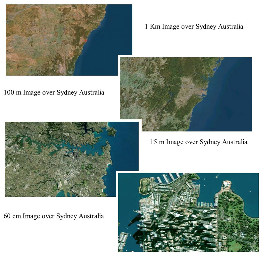
In the process of generating a zoom from space to ‘in your face’ it is necessary to use imagery at varying resolutions. Without getting into specifics, WorldSat uses four levels of imagery designated (from lowest to highest resolution) 1Km, 100 m, 30 m, and 60 cm. All 60 cm data is embedded in 15 m data to better integrate it into the 100 m or 30 m imagery.
Because the perception of the colour of an area will vary as the distance from the object increases it is essential to balance the colours between resolutions if you are to obtain a seamless zoom sequence. One layer must bleed into the next without a noticeable colour shift. That is WorldSat’s particular talent. We colour balance not only between mosaiced imagery at a given resolution but also between different resolutions, which can be seen in some of the zoom sequences on our web page. The trick is to go from the first image on this page to the last without any perceptible colour shift.